TPE 3D Review
Share
For years The Photographer’s Ephemeris has been an indispensable tool for landscape photographers. It has helped us plan many shoots to understand where the sun or moon was going to land on the landscape, or where the sun/moon/milky way would be in the sky. TPE has always been 2D map based, while useful, it was limiting for truly visualizing how the scene would look. I would typically use TPE in conjunction with Google Earth to understand how the light and shadows would look on the mountains, but Google Earth’s representation leaves something to be desired as well. Along with this, the display of the milky way is incorrect in Google Earth making it useless for planning night shots.
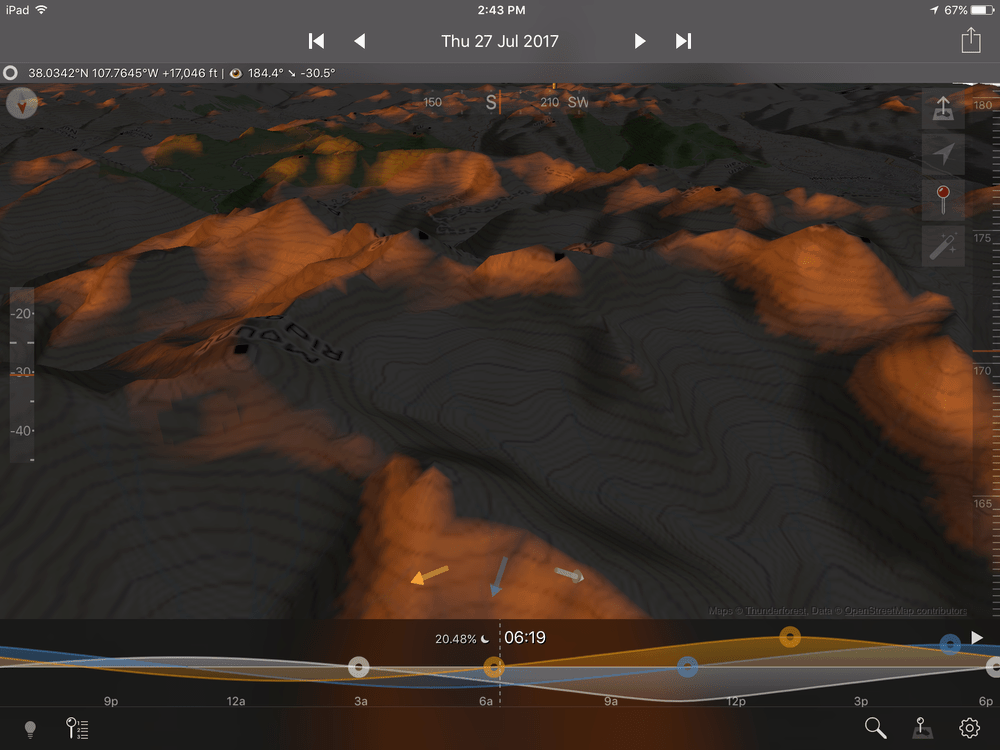
Obviously, Stephen Trainor (the developer of TPE) saw this gap in the market and grabbed the bull by the horns. Stephen’s latest game changing app is TPE 3D, a revolutionary piece of work that allows you to fly around the earth with three-dimensional terrain similar to Google Earth. The fun begins when you change the time to be near sunrise or sunset, suddenly the 3D landscape transforms with beautiful shadows and glowing peaks.
Planning out a night shoot is now a breeze using TPE 3D. Select a location, place a pin by long pressing, then double tapping the pin to fly to it. You will now be at ground level and in enhanced mode. Slide the time slider so it is night and you will see the sky transform to be filled with stars, constellations, milky way, and the moon. Change the time and the date until you find the correct position for the milky way or another subject that will align with your land subject. You can then change your focal length by pinching to zoom in or out, no more guessing what lens to bring!
 A planned shot of the milky way over Swiftcurrent Peak in Glacier National Park
Drone photographers rejoice! You now have the perfect tool to plan out drone shots. In TPE 3D you can see what elevation your camera is positioned along with GPS coordinates. With an app like Autopilot or Litchi, you can pre-plan your shoot and then enter the exact location for the drone to fly to, saving precious battery life finding a composition. Of course, it’s not perfect, and you will likely have to do some exploring/tweaking to get just the right location in the field, but this should save you a lot of time.

Stephen has put together many tutorials, and video tutorials below.
Flying Mode Tutorial
Enhanced Mode Tutorial
Map Pin Basics
Timeline Basics
The app is not perfect of course, the detail of the topo and overlaid satellite imagery in Google Earth is light years better, but it is not intended to be used in this way. In my view it is best used when you already have an idea of where you want to shoot, but you want to better visualize how the light will land on the landscape prior to your shoot, or find out exactly where the milky way will be in relation to the landscape. This app has become an indispensable tool in my planning kit, I highly recommend it!
